| Slovakia Genealogy Research Strategies | ||||||
| Home | Strategy | Place Names | Churches | Census | History | Culture |
| TOOLBOX | Contents | Settlements | Maps | FHL Resources | Military | Correspondence |
| Library | Search | Dukla Pass | ||||
SLOVAKIA
Starina Reservoir Village Evacuations
(Starinska vodna nadrz)
Dara, Ostroznica, Starina, Smolnik, Velka Polana/Polana, Ruske & Zvala
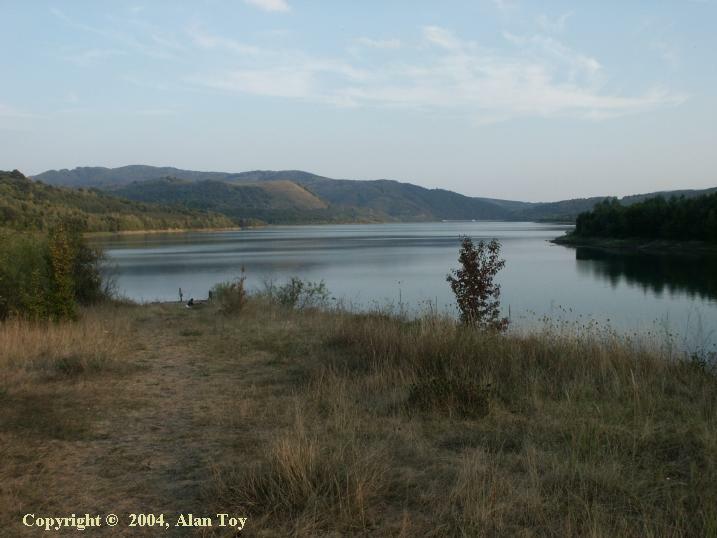
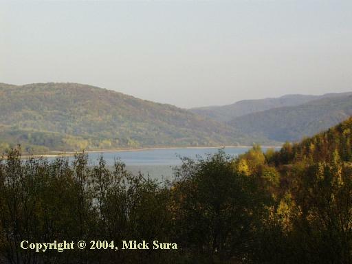
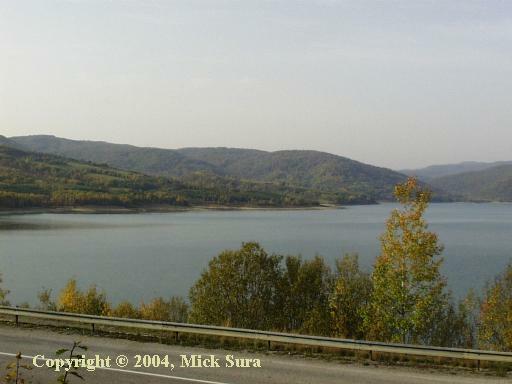
Reservoir Looking South, 2003
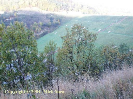
Seven villages along and near the northern reaches of the Cirocha River, near the Poland border ceased to exist in 1980 after the construction of the Starina dam and reservoir. Most of the residents moved either to Snina or the city of Humenne and environs. These villages include [Slovak(Magyar)]: Ostroznica (Osztroznica), Smolnik (Zemplen Szomolnak), Velka Polana/Polana (Nagy Polena), Starina (Sztarina, Cirokaofalu), Dara (Dara, Dare), Ruske (Oroszruszka, Zemplenoroszi) and Zvala (Zuella). Many original roads still exist along these old byways, but are closed and limited to foot traffic. Uniquely, the church from Dara remains standing, but appears unused (2001). If these are your villages, I have 1914 and a 1937 1:75,000 maps of these villages that I would be pleased to send along to you.
Many of these villages are now a part of the Poloniny National Park and East Carpathian Biosphere.
These villages were incorporated into the township of Stakčín on the following dates:
1981 - Ostroznica, Smolnik, Velka Polana
1985 - Starina
1986 - Dara, Ruske, Zvala
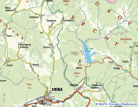
You will not find these villages on contemporary maps. I have noted in red on the Slovakia Villages page map the general location of each village.
Church Records at the LDS
Due to village closures and the communist shutdowns, the following table describes where the church records for each village are filed in the Presov State Archives. These archives were filmed by the Mormons and you can find village church records filed accordingly. Thanks to Vladimir Bohnic for providing this information.
Village (Slovak) Village (Magyar) Greek Catholic Roman Catholic 1914 Pop. Earliest
Record
D Ru M P RC GC IZ Dara Dara Starina Snina 154 1773 2 151 - - 2 151 - Ostroznica Osztrozsnicza, Szedreske (missing) Snina 176 1773 10 157 - - - 166 10 Ruske Oroz Ruszka Ruske Snina 428 1773 - 422 2 - 6 410 12 Stakcin Sztakcsin Stakcin Snina 1315 1773 93 881 109 201 331 957 79 Smolnik Szomolnok Ujszomolnok*, Zemplenszomolnok (note: now part of Stakcin)
Missing - reported destroyed WW2(1) Snina 375 1773 9 349 - - 366 8 Starina Sztarina Czirokaofalu* Starina (FHL filed under Humenne) Snina 758 1773 27 674 29 - 28 694 32 Ulic Utczas, Ulics Ulic, Snina ? 998 54 884 31 - 31 906 59 Velka Polana Nagy Polena, Nagypolany (note: now part of Stakcin)
Starina(SK Archive
Satoraljaujhely (HU Archive) Note (2)Snina 705 1773 88 577 18 - 8 606 91 Zvala Zello, Zuella ? Snina 441 8 424 8 - - 433 4
It is interesting to note that while the majority of these villages' population was Rusyn, the whereabouts of the many Greek Catholic records is uncertain. The SR archives indicates the Roman Catholic records are stored with Snina records. It's possible however that there was an indexing error.
|
|
|
|
|
,%20Dara%20to%20the%20R%20(E).jpg)

Photo Gallery Credit: Mick Sura unless otherwise noted
2003 photos by Maureen Mikovics Pulignano - Uzhhorod, Snina, Starina Reservoir, Humenne, Dhle nad Cirochou
Rusyns - Lost Homes - A picture essay of the land of the seven villages cleared to make way for the Starina Reservoir. (2006)
(1) Reported by Gloria Kurbanick, 2009
(2) Mick Sura reports that no Velka Polana church records will be found in the Slovak State archives. However records from 1821-1881 Can be found in the Zemplen regional archive in Satoraljaujhely (Hungary).
MAPS
|
BEFORE 1997 Topographical Map |
|
BEFORE 1925 Topo Map (1.4MB) |
|
AFTER Current Road Map - general |
|
AFTER Current Topo Map #2 - detail |
Links to off-site webs will open in a new window. Please disable your pop-up stopper.
Last Update: 15 November 2020 Copyright © 2003-2021, Bill Tarkulich