| Slovakia Genealogy Research Strategies | ||||||
| Home | Strategy | Place Names | Churches | Census | History | Culture |
| TOOLBOX | Contents | Settlements | Maps | FHL Resources | Military | Correspondence |
| Library | Search | Dukla Pass | ||||
Dara (Dare)
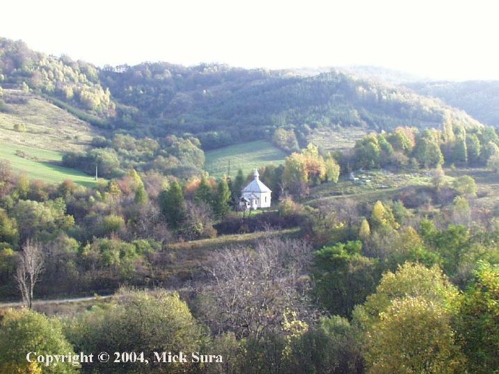
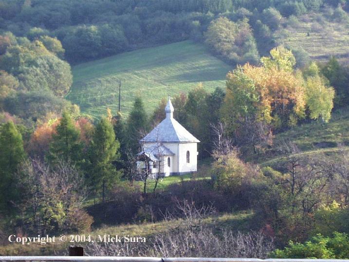
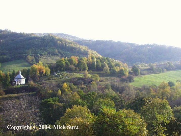
Village was evacuated in 1980 as it was in the watershed area for the construction of the Starina Reservoir. Only the church appears to remain.
|
Village Information |
Village Links |
Regional |
|
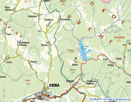
1997 Topographical Map |
Online Historical Book: Below Snina Rock (1964) |
|
| Starina Reservoir | ||
|
Reference in Wooden Church book from Folk Museum of Ukrainian Culture at Svidnik |
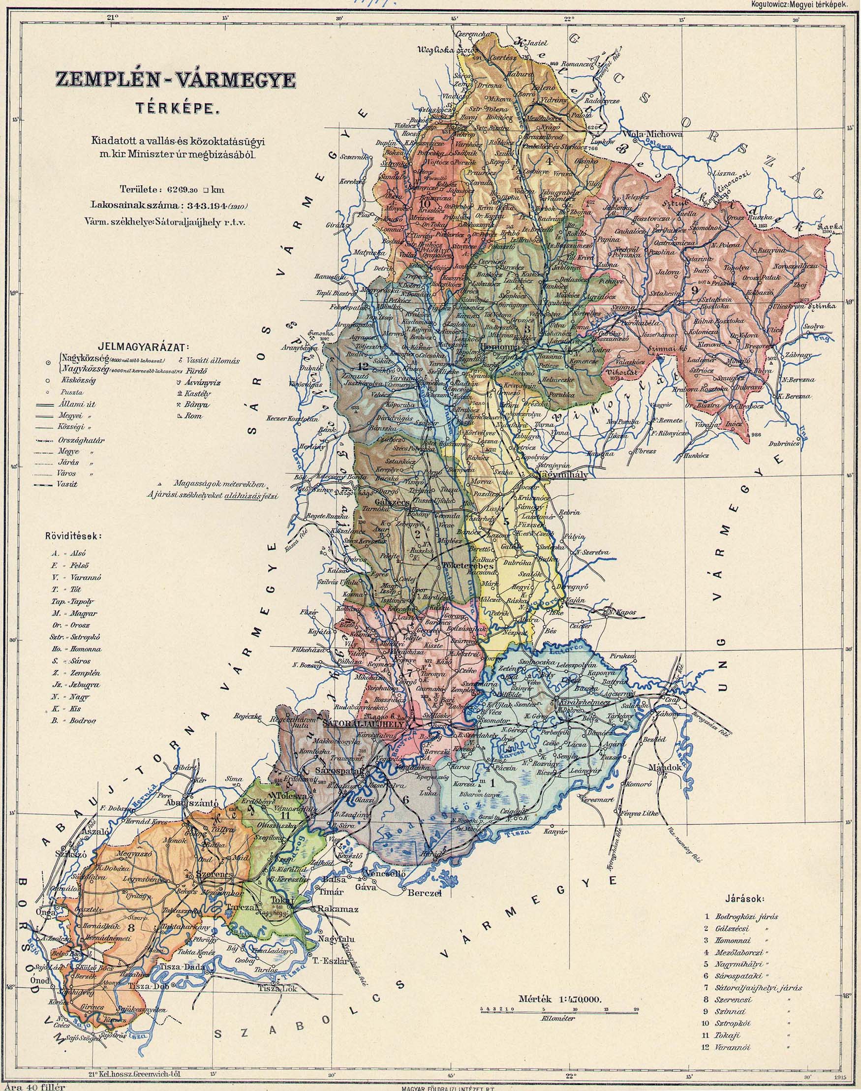
1914 Zemplin County Map (714KB) |
|
|
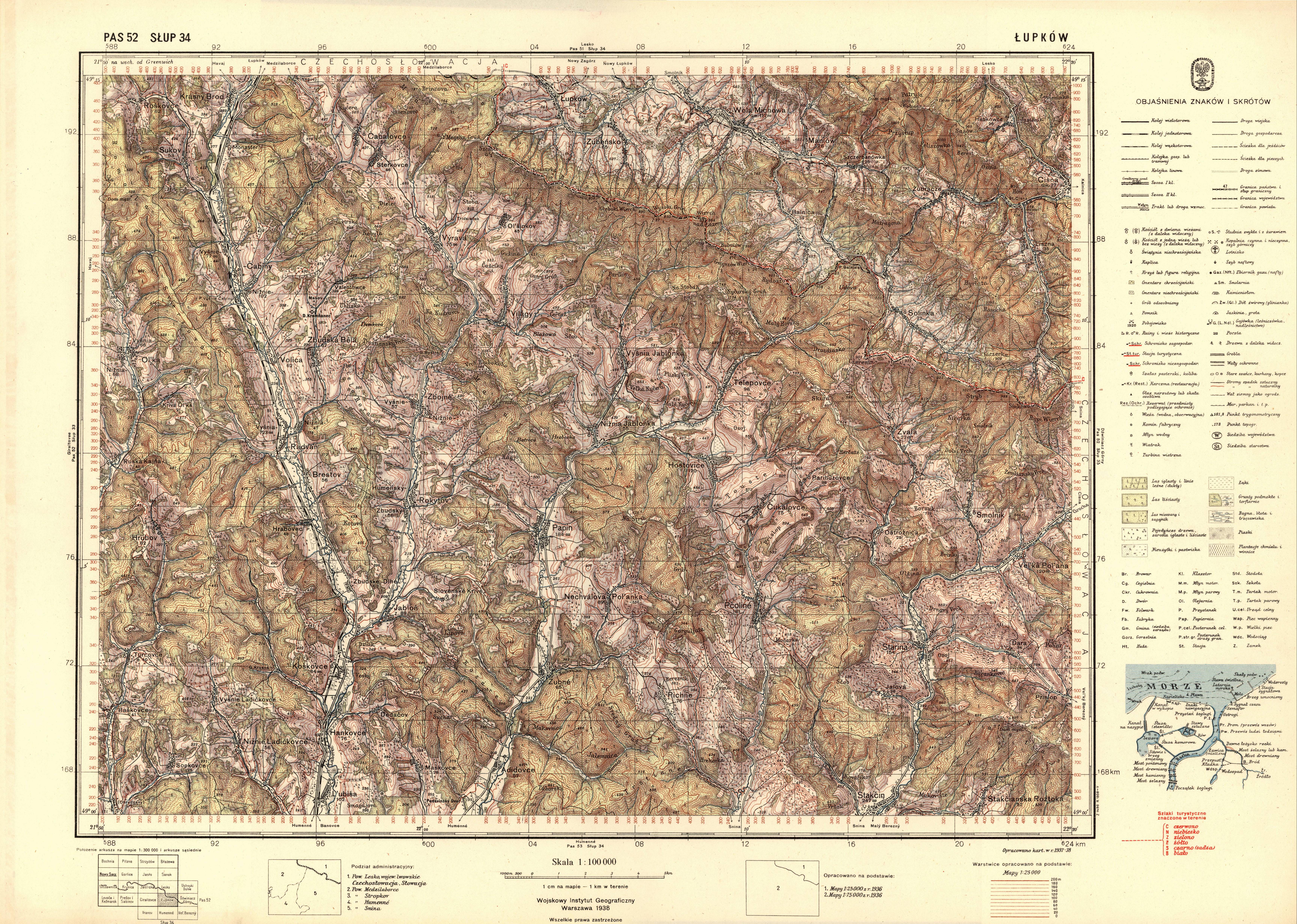
1925 Topo Map (1.4MB) |
||
Highlights
| Earliest Record |
1598 |
| 2001 Population | 0 |
| 1914 Population |
154 2 German, 151 Ruthenian; 2 Roman Catholic, 151 Greek Catholic |
| Village Names | Dara, Dare |
| Owners | Originally in the Humenne Estate, later to the noble family Okolicsány. In the 19th century it belonged to the Lonyay noble family. |
History
Dara originally belonged to the feudal dominion of Humenné. In 1787 ownership passed to the Révészóy (Révészov) noble family, having 83 houses and 550 inhabitants. In 1828 there were only 24 houses and 182 inhabitants in 1828. In the 14th century it belonged to the noble Zámbory family. During it's history, its inhabitants were employed in agriculture and as wood-workers.
Source: Vlastivedný Slovník Obcí na Slovensku Bratislava 1977
This village is now a part of the Poloniny National Park.
1598 Dara. It belonged to the town of Humenné, and in the 1787 to nobles Révészóy (Révészov) when it got 83 houses and 550 inhabitants ( but only 24 houses and 182 inhabitants in 1828). In the XIX century it belonged to nobles Zámbory. During the History, its inhabitants were occupied in agriculture and as wood-workers.
Source: Roberto Cannoni, Italy
Photos
|
|
Rusyns - Lost Homes - A picture essay of the land of the seven villages cleared to make way for the Starina Reservoir. 2006
Surnames
Surname (Researcher)
BASOS
Polyak, Plej, Americanized as "Pollock"
2000 Photo Credit: Mick Sura
Links to off-site webs will open in a new window. Please disable your pop-up stopper.
Last Update: 15 November 2020 Copyright © 2003-2021, Bill Tarkulich